
MicaSense Systems
At FSF we have two MicaSense systems - the Altum and the RedEdge-M. Both are multispectral cameras, and are fully intergrated on our UAV systems.
MicaSense Altum
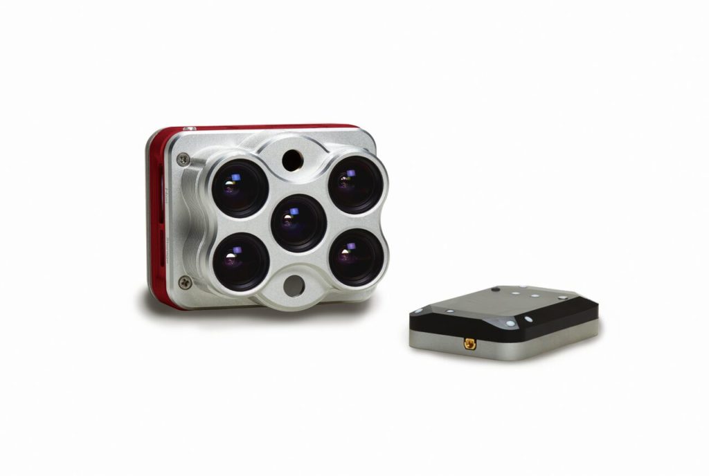
Features
Synchronized capture of multispectral, thermal, and highresolution imagery. Calibrated thermal and multispectral outputs. High resolution multispectral images. Integrated GPS, with downwelling light sensor (DLS 2).
Center Wavelengths
Blue 475 nm, Green 560 nm, Red 668 nm, Red edge 717 nm, Near infrared 840 nm, and Thermal 11 µm.
Example Applications
Micasense RedEdge-M
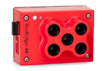
Features
RedEdge-M has five bands-blue, green, red, red edge, and near-infrared. It is provided with a downwelling light sensor (DLS).
Specs
| Weight: | 173 grams (6.1 oz) (includes DLS and cables) |
| Dimensions: | 9.4 cm x 6.3 cm x 4.6 cm (3.7 in x 2.5 in x 1.8 in) |
| External Power: | 4.2 V DC - 15.6 V DC 4 W nominal, 8 W peak |
| Spectral Bands: | Blue, green, red, red edge, near-IR (global shutter, narrowband) |
| RGB Color Output: | Global shutter, aligned with all bands |
| Ground Sample Distance (GSD): | 8 cm per pixel (per band) at 120 m (~400 ft) AGL |
| Capture Rate: | 1 capture per second (all bands), 12-bit RAW |
| Interfaces: | Serial, 10/100/1000 ethernet, removeable Wi-Fi, external trigger, GPS, SDHC |
| Field of View: | 47.2° HFOV |
| Custom Bands: | 400nm - 900nm (QE of 10% at 900nm) |
| Triggering Options: | Timer mode, overlap mode, external trigger mode (PWM, GPIO, serial, and Ethernet options), manual capture mode |
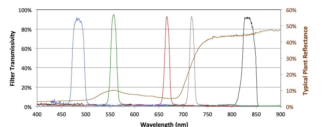
Wavelength Characteristics
Band Number Band Name (nm) Centre Wavelength(nm) Bandwidth FWHM(nm) S1 Blue 475 20 S2 Green 560 20 S3 Red 668 10 S4 Near IR 840 40 S5 Red Edge 717 10
Example Applications
| Band Number | Band Name (nm) | Centre Wavelength(nm) | Bandwidth FWHM(nm) |
| S1 | Blue | 475 | 20 |
| S2 | Green | 560 | 20 |
| S3 | Red | 668 | 10 |
| S4 | Near IR | 840 | 40 |
| S5 | Red Edge | 717 | 10 |
UAV Systems
The MicaSense unit and DLS will be supplied fully integrated with a UAV system. This will ensure that each image is accurately time and geostamped for prostprocessing.
These will be supplied with either:
DJI M100
DJI M210


Privacy Notice Accessibility Notice