Headwall Nano nNP Hyperspectral Imager
Overview
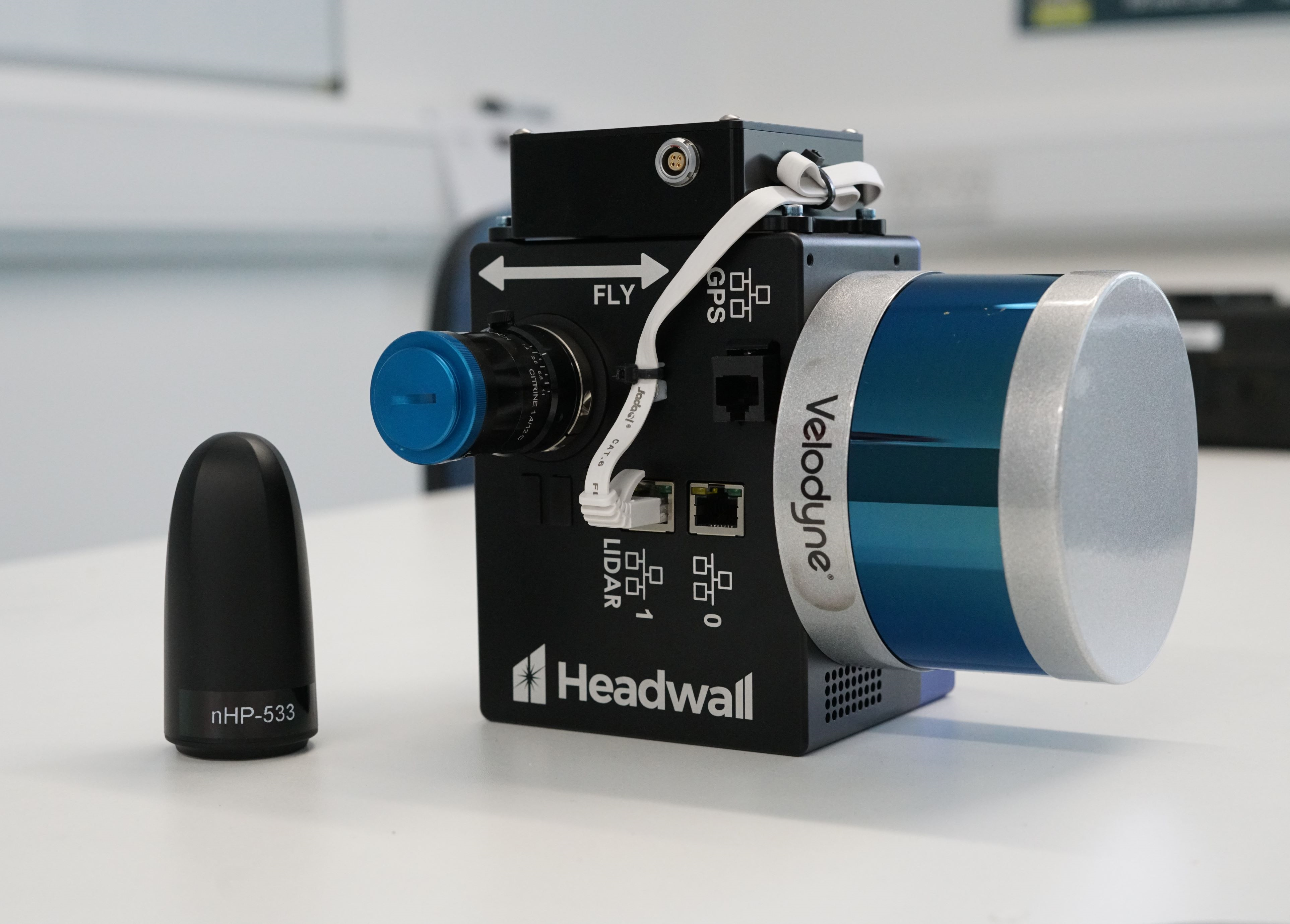
The Headwall Nano (nHP) VNIR and LiDAR UAV mounted sensor is a leading hyperspectral push-broom imager, capable of superb spectral and spatial resolution.
This system provides high spatial resolution (c. 5cm GSD), 3D projected, full-range VNIR hyperspectral imagery to support a wide range of applications, including mapping and monitoring of vegetation, plant species, biodiversity, biomass, stress indicators, disease, agriculture, geology and archaeological sites.
The attached 16 channel LiDAR, an upgraded version of the LiDAR on our Headwall Co-Aligned system, allows orthorectification of flight lines over complex terrain and fusion with the hyperspectral datacube for three dimensional representation of spectral data and integration of LiDAR-based biomass estimates with different spectral products.
This sensor is available to all NERC grants, with FSF covering flight and operation of the sensor, as well as processing of the data to surface reflectance. Please contact us at least one month prior to your application deadline to discuss your project. We will then ask you to fill out a form outlining your proposal. This allows us to make a decision about the suitability of the system and the chosen research location to the Headwall system.
Note: If Headwall flights are not written into a grant, staff costs for flights, travel and subsistence will need to be covered by the loan user.
Features
The Headwall Nano system is mounted on a DJI M350. The system can achieve data acquisition times of up to ~30 minutes. Area covered is dependent on the spatial resolution and spectral resolution required by the end user, and lighting conditions.
Example Conditions
Fine Spatial Resolution (50 m altitude)
| Ground Sampling Resolution | 30 mm |
| Km² per battery set | 7 |
| Flight Time | 25 mins |
Medium Spatial Resolution (50 m altitude)
| Ground Sampling Resolution | 60 mm |
| Km² per battery set | 14 |
| Flight Time | 25 mins |
FSF has significant battery capacity, and can accommodate multiple flights. Details of your flight requirements will take place during your loan assessment, and – if successful – during your training with the FSF.
Technical Specification
| VNIR | |
|---|---|
| Spectral Range | 400 nm – 1000 nm |
| Spectral Bands | 340 |
| Spatial Pixels | 1020 |
| Dispersion per pixel | 1.76 nm / pixel |
| FWHM (nm) | 8 |
| f/# | 2.5 |
| Max Frame Rate (Hz) | 250 |
| LiDAR | 16 channel Velodyne (VLP-16) |
| GPS | Trimble Applanix APX-15 |
Units Available for Loan
| Model and Serial Number | Documents and Software |
|---|---|
| Headwall NanoHP VNIR Sensor | Datasheet |