Example Workflow
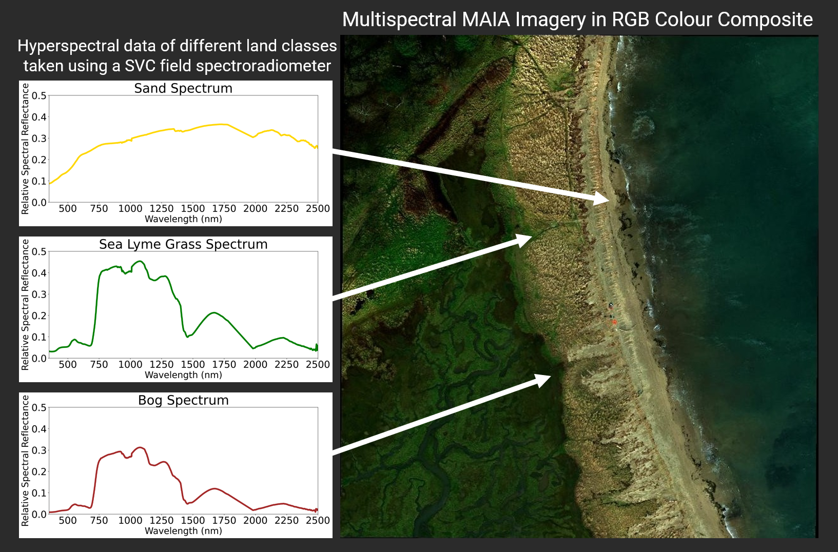
The image below shows a colour view (red, green, blue – RGB) collected using a MAIA multispectral camera mounted on a DJI M210 drone during a survey at Tyninghame Beach. The MAIA captures multiple narrow “bands” of reflected light beyond what a normal camera can see, allowing us to distinguish different coastal features like sand, bog and coastal vegetation.
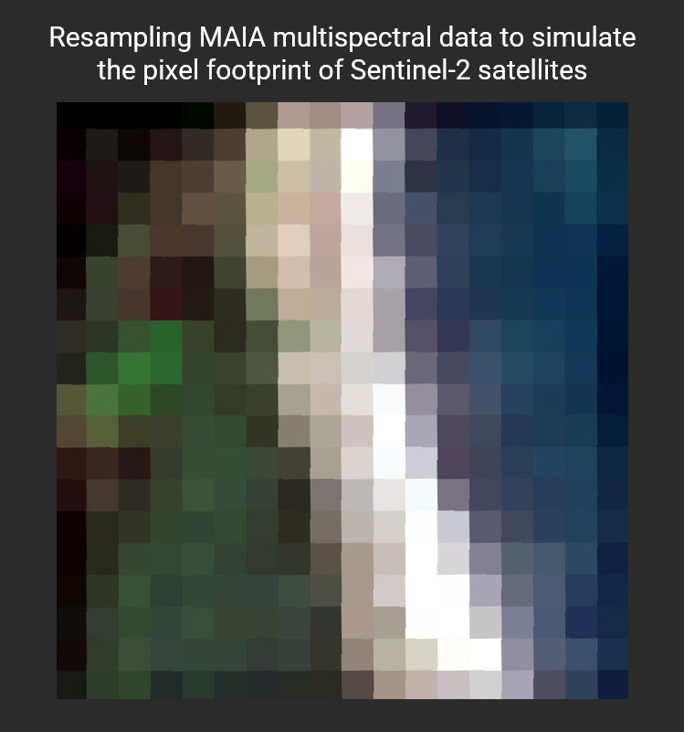
A major advantage of the MAIA system is that its bands are specifically designed to match those used by Earth-observation satellites such as Sentinel-2 or WorldView-2 (depending on the MAIA model). This means the drone data can act as a “bridge” to satellite imagery—we can directly compare what the drone sees with what the satellite sees from space. This makes the drone data an excelled validation tool—helping us check how accurately the satellite is mapping different land classes.
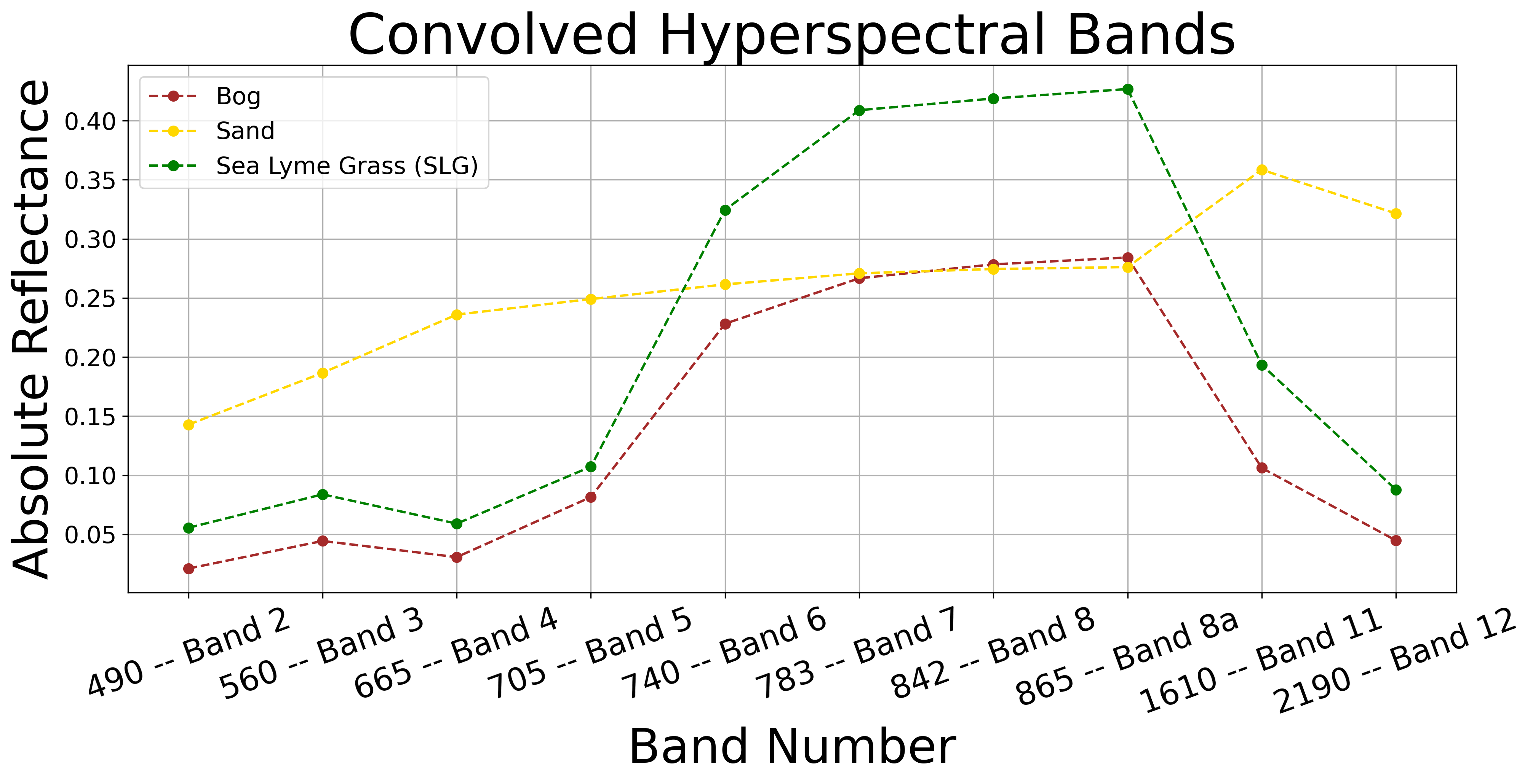
We also collect hyperspectral measurements on the ground using a field spectrometer. These measurements capture the full reflectance signature of different land types. By matching these precise ground spectra to the MAIA and satellite bands, we can check how accurately different materials are represented in imagery at different resolutions. This validation gives us confidence to scale our analysis up to satellite level, where we can map and monitor coastal environments more efficiently